Drawn to The Greater London Thames Path: South Section 1a & 1b
- Graeme Stoten

- Jun 17, 2022
- 3 min read
Updated: 14 hours ago
Teddington Lock - Richmond - Mortlake: 7 miles (11 km)
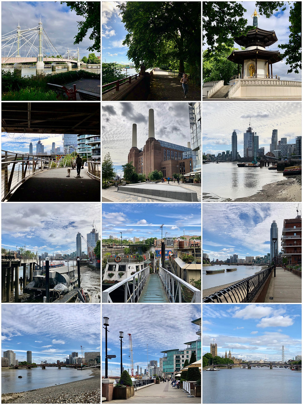
‘Teddington Lock’ on the south bank of the River Thames serves as the starting point of the Transport for London (TfL) Thames Path South, National Trail and my choice to begin this 80 mile staged return walk. Historically known for being the largest complex of locks on the river, they serve as the essential division between the tidal and non-tidal part of the river Thames. On passing the Barge lock to the left, the path, now a wide and very accessible compressed gravel path through to Petersham Meadows, leads on through delightful shaded rural woodland. En route, a small stone pillar to the left at riverside, marks the boundary between the Port of London Authority and Enviroment Agency’s jurisdiction over the river and on crossing a lock bridge further ahead to a lagoon on the right, the home of the Thames Young Mariners Education Centre. Unmistakable as it comes into view and with it, the whoops and hollers of youngsters enjoying a wide array of water sports. Continuing through the Ham Lands nature reserve, and passing the infamous Eel Pie island (more to speak of much later), Radnor House clock tower catches the eye on the North bank through the lush riverside foliage.

Upon reaching the meadows and environs of beautiful Ham House (1610) to the right, the expanse of the river opens up to reveal the Star and Garter atop Richmond Hill and finally a clear view of the to and fro of river traffic and the opposite North Bank. The path takes a sharp arc now following the river adjacent to Petersham Meadows, or if preferred, an alternative grassy path in the meadow itself alongside the flood defences noting the quiescent grazing cattle. Having entered Buccleuch Gardens, the long riverside Promenade stretches ahead and passes by the Richmond Canoe club, eateries and relaxing open green gardens to eventually arrive at iconic Richmond Bridge (built in 1776 of Portland stone).
Historical 18th Century Richmond waterfront offers much in the way of pleasure and entertainment, pubs, cafes and restaurants. The pier and landing stages provide an opportunity to embark on trips to further outreaches of the Thames via River Boat, and rowers, paddle boarders and boaters populate the river alike. Continuing along the Promenade passing Old Palace Lane with access to Richmond Palace and Asgill House, the path now passes under Victorian, Richmond Railway Bridge (rebuilt in 1908 replacing cast iron with steel) and Art Deco, Twickenham Bridge (built in 1933 of reinforced concrete) to bring this section (1a) of the trail to a close.
Continuing on from under the graceful arch of Twickenham Bridge, the path now stretches ahead with Old Deer Park to the right (the deer now moved to Richmond Park) and the recently restored Richmond Lock and Weir (1894) approaching to the left. At this point the footbridge gives access to the far bank and this is where The Capital Ring and the Thames Path part company from there shared route through Richmond. Downstream from here the river is fully tidal and offers many treasures to discover at both low and high tides. The delightful shaded woodland path now skirts behind the Royal Mid -Surrey Golf Club eventually bringing Old Isleworth and All Saints church into view on the opposite bank. Adjacent to Old Isleworth lies Syon Park (more of on the return leg) but a little further on to the right a view of the King‘s Observatory commissioned by George III in 1769 can be caught via a keyhole break in the tree line along with the Northern Obelisk. The path leads on retaining a very pleasant rural character following the broad arc of the river and the perimeter of the Royal Botanical (Kew) Gardens, home to the largest collection of flora in the world.

The vista eastwards opens up at this point as tower blocks come into view, redolent of the great urban sprawl that lies ahead. Passing Kew Palace and the Kew Herbarium Library the archway of Kew bridge gives passage to continue, uninterrupted, along an almost perceptively straight compressed gravel path. Leading on under the imposing wrought iron, Kew Railway Bridge (1869) the path again remains shaded and delightfully bucolic. Shortly after, the communal gardens of the National Archives tempt diversion to the right but then passing the Putney Town Rowing club and as the path broadens further, the Mortlake Cemetry, Chiswick Bridge comes into full view. Built as a reinforced concrete deck arch in 1933 to relieve traffic congestion it is bold and surprisingly elegant and provides a fitting waypoint to close this section (1b) of the trail.


Comments