Drawn to The Greater London Thames Path: South Section 1c & 1d
- Graeme Stoten

- Jun 22, 2022
- 3 min read
Updated: Jun 3
Mortlake - Putney Bridge - Battersea Park: 8 miles (13 km)
Rejoining the path at Chiswick Bridge, passing underneath its sturdy Portland Stone faced archway leads riverside again and finds urban Mortlake. The Ship Pub and historically significant Stag Brewery squat adjacent to one another and acknowledging both, the now cobbled path stretches onwards. Often flooded at high tide, on this occasion was still very silty and in fact under part diversion whilst riverbank works were being undertaken. Retaking the path at the White Hart Pub, overlooking Dukes Meadow on the North bank and Barnes railway bridge on the horizon, the Barnes Promenade is quickly reached. A concrete stretch riverside passes by Blue plaque Victorian dwellings and the reputed Bull’s Head Pub. With Chiswick Pier coming into view downstream, the path leads into a very pleasant woodland, immediately apparent of which is the symphonic birdsong coming from the Leg O’ Mutton nature reserve of which the path traces out its entire length. A brief diversion can be made after a short while to visit, and walk the circumference of the lake.

Continuing along the compressed gravel and stone path with glimpses of Chiswick Mall (more of later) on the opposite bank, St. Paul’s School (1968) of Cathedral fame, emerges to the right with its vast playing fields. As the river arcs around the bend, Hammersmith Bridge (built in 1887 as a wrought iron suspension bridge) dominates the view with its ostentatious ornate design. Ducking under the low spanning arch, and shortly further on, Harrods Village appears and the impressive Harrods Furniture Depository. A formidable terracotta, red brick building built in a Baroque Victorian style, now converted into apartments. The path now widens skirting the London Wetland Centre, an extensive site of lakes meadows and reed beds and home to many species of bird and amphibians. With Craven Cottage now in profile on the north bank and the town centre of Putney encroaching with tower blocks beyond, the path finally reaches the Embankment having crossed Beverley Brook. Passing Leaders Gardens, and a chance for a respite in the shade, the Embankment plays host to many of Londons famous school rowing clubs. Avoiding high tide, access straight along to Putney Bridge with a small diversion past the Thai Square and ‘Load’ one of a handful of sculptures on the Putney Sculpture trail, brings section (1c) to a close.
Crossing Putney High Street and weaving through the square alongside St Mary’s Church (circa 15th Century) with eye catching blue clock and sun dial, the modern terrace, offering a fine view of stone built Putney Bridge (1886), passes the Boathouse pub and then turns into Deodar road. Passing under the railway line and through Blade Mews, the path enter’s Wandsworth Park, and turning left to reach the waterfront, a beautiful avenue of trees lies along the edge of the large recreational park area. The wide gently curving path provides lovely shelter with the adjacent trees along its length and the breeze off the river, very refreshing on this hot day. Leaving the park and passing Lighterman’s Walk, a lovely mooring site for houseboats and barges, the route turns away from the river through a striking new estate of modern flats.

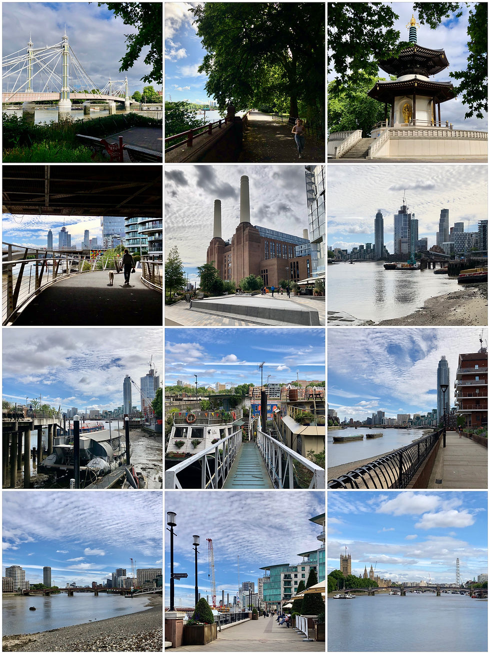
Emerging from the sleek apartment blocks the path heads straight over the River Wandle via a two-part footbridge offering views of the Thames and a small park on the spit to the south. A short industrial section, leading past the imposing Western Riverside Waste Authority complex, and finally onto Smugglers Way, allows the safe return to the riverside via Waterside Path. Quite a breathtaking view takes shape with both modern stepped and imaginative curved glass apartments blocks contrasting with piers and terraces along the route, and the hustle and bustle of river traffic. Passing under Wandsworth Bridge and further on The Waterfront Pub, characterful Dutch barges on the Plantation Wharf remind of the maritime history still present today on the river. Following Sherwood Wharf, Bridges Wharf and circumnavigating the London Heliport and with a quick break through St Mary’s Churchyard, the trail continues along Morgan’s Walk. Drawing the eye across to the opposite bank, The Lots Road Power Station dominates the view between two very modern tower blocks, presently being redeveloped as part of a glamorous quarter known as the Chelsea Waterfront. Battersea Bridge now lies ahead (1885, designed once again by Joseph Bazalgette) and beyond via modern redeveloped Albion Terrace and passing Ransome’s Dock, the picturesque Albert Bridge, which now brings section (1d) to a close.


Comments